 BGS Data Catalogue
University of Plymouth
Type of resources
Topics
Keywords
Contact for the resource
Provided by
Years
Formats
Representation types
Update frequencies
-
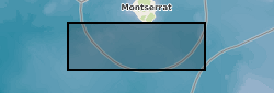
Our proposed research is based on cores collected during the recent, and very successful, Integrated Ocean Drilling Program (IODP) Expedition 340. The aims of this expedition were to investigate the volcanism and landslide history of the Lesser Antilles volcanic arc, by collecting a number of cores offshore Montserrat and Martinique. As a shipboard planktic foraminifera (single celled calcareous plankton) biostratigrapher (dating sediment cores using the appearances and disappearances of fossil plankton), Deborah Wall-Palmer (proposed PDRA) has access to these cores during the one year moratorium period. Until IODP Exp. 340, the longest continuous record (~250,000 years) of volcanic activity on Montserrat was a 5.75 m core collected to the south-west of the island in 2002, CAR-MON 2. This core revealed a more extensive and complete record of volcanic activity than that available in terrestrial cores. The longest continuous sediment record collected during Exp. 340 extends this record considerably. At 139.4 m in length, Hole U1396C records events back to 4.5 million years ago. The majority of this Hole will undergo stratigraphic analysis at low resolution, which will be carried out by other Exp. 340 scientists (Andrew Fraass, Mohammed Aljahdali). The upper 7 m section of this Hole is estimated to span 300,000 years and is comparable to the time period recovered in sediments for Holes U1394A/B (0 to 125 cm) and U1395B (0 to 30 cm). Holes U1394A/B and U1395B were collected close to Montserrat, in the main path of eruptive material from the Soufriere Hills volcano and contain a high resolution, but interrupted record of volcanic eruptions and landslides. Our proposed research is to provide a high resolution (every 2000 yrs) age framework across the upper ~300,000 year sections of these three cores. This will be achieved by collecting specimens of the planktic foraminifera Globigerinoides ruber and analysing the stable oxygen isotope ratios contained within their calcium carbonate tests (shells). Oxygen isotope ratios provide information about the global ice volume and global climate, and the standard record can be identified world-wide. Correlation to this record can therefore be used to provide an age framework for sediments, which is more detailed than using the biostratigraphic range of species alone. Producing this age framework is essential for achieving the overall aims of Exp. 340 as it will be used, in collaboration with several other Exp. 340 scientists, to reconstruct the volcanic and landslide history of Montserrat. In addition to this, to ensure the conservative use of samples, some further work will be carried out on samples requested from the upper 7 m of Hole U1396C. This will assist in constructing the low resolution stable isotope and biostratigraphic framework for the remainder of this Hole. The majority of this work is being carried out by Andrew Fraass (University of Massachusetts) and Mohammed Aljahdali (Florida State University). We will analyse the upper 7 m of Hole U1396C, at low resolution, for stable oxygen isotopes of the benthic foraminifera Cibicidoides spp. and for planktic foraminifera datum species.
-

This dataset (1.5 GB) comprises SO2 emission data (SO2 camera and DOAS) of parts of the active 2013 phase from Colima, as well as Scanning electron microscope (SEM) images and microprobe data of the collected ash from explosions and lava and dome rock. These data were used in the following paper: Cassidy, M., Cole, P.D., Hicks, K.E., Varley, N.R., Peters, N., Lerner, A. 'Rapid and slow: Varying ascent rates as a mechanism for Vulcanian explosions' Earth and Planetary Science Letters. 420: 73-84. doi:10.1016/j.epsl.2015.03.025
-
Stable Isotope and trace element analyses (Ca, Sr, Mg, Fe and Mn concentrations) derived from Cretaceous Belemnites including Duvalia tornajoensis, D. cf. lata constricta, D. binervia, D. cf. emericii, Hibolithes, H. cf. jaculoides, Berriasibelus, Castellanibelus and Pseudobelus.
-

Clumped isotope analyses, raw data, replicates and temperatures calculated using the empirical calibration of Wacker et al. (2014), recalculated using the [Brand] isotopic parameters.
-
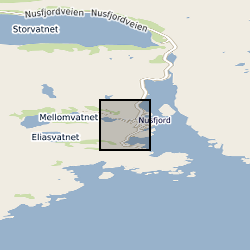
The database contains field measurements and field descriptions of pseudotachylytes and mylonites that formed at lower crustal conditions and that are now exposed on the Nusfjord ridge, Lofoten, northern Norway. The field measurements were used to derive earthquake source parameters associated with the generation of the Nusfjord pseudotachylytes.
-
The dataset contains information on the crystallographic orientation and on the grain size of minerals in the brittle-viscous shear zones. The methodology used to generate it is polarized light microscopy, scanning electron microscopy (SEM) and electron backscatter diffraction (EBSD)
-

Data from the IODP Expedition will be archived by the International Ocean Discovery Program, including all data generated during the shipboard palaeomagnetic and magnetic anisotropy analyses and all of the logging data (FMS tool, GBM data), plus associated explanatory notes. Shore based palaeomagnetic and magnetic anisotropy data, FMS---based reorientation parameters, and downhole magnetizations inferred from modelling of the GBM borehole magnetometer data will be made available to the international community via appropriate IODP Data Reports (in addition to primary journal articles). Data Includes: Shipboard cryogenic magnetometer data Shipboard and shore based discrete sample remanence data Shipboard and shore based magnetic anisotropy data FMS---based reorientation parameters Magnetic parameters modelled using borehole magnetometer data
-

The dataset consists of eleven spreadsheet tabs, each tab containing lipid biomarker palaeothermometry (air temperature reconstructions) and bulk organic carbon isotope data from individual lignites that are known to stratigraphically span the Cretaceous-Palaeogene (K-Pg) boundary. Uncalibrated, raw biomarker distributions (glycerol dialkyl glycerol tetraethers; GDGTs) are provided, as well as the calculated calibration outputs. Site coordinates are: West Bijou, Colorado (39°34'14'N, 104°18'09'W), Sussex, Wyoming (43°39'40"N, 106°19'06"W), Pyramid Butte, North Dakota (46°25'03'N, 103°58'33'W), Hell Creek Road, Montana (47°31'35"N, 106°56'23"W), Rock Creek West, Saskatchewan (49°02'20"N, 106°34'00"W), Wood Mountain Creek, Saskatchewan (49°25'20"N, 106°19'50"W), Frenchman Valley, Saskatchewan (49°20’56"N, 108°25’05"W), Knudesn’s Coulee, Alberta (51°54’27"N, 113°02’57"W) Griffith’s Farm, Alberta (51°54’47"N, 112°57’51"W), Coal Valley Cores (GSC CV-42-2, Cores 1 and 2), Alberta (53°05’02"N, 116°47’ 40"W) Police Island, Northwest Territories (64°52'42"N, 125°12'33"W).
-
Polygon inventory of 481 landslides mapped along the Arniko Highway, Nepal (NERC Grant NE/L002582/1)
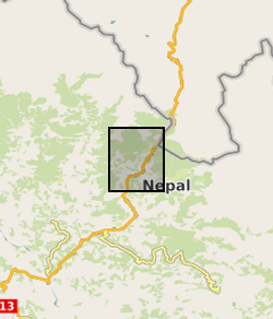
Polygon shapefile including 481 coseismic and climate triggered landslides mapped along the Arniko Highway, Nepal, using a combination of field mapping and remote sensing. All mapped landslides were those visible in the landscape during the period 2017 – 2018. Landslides were mapped using a combination of field and remote sensing methodologies (see lineage). The inventory includes the landslide locations, perimeters (Length field), areas, types (for field mapped landslides), and whether a given landslide was mapped in the field or remotely (source field). These landslides were mapped for a range of purposes, from conducting landslide susceptibility assessments, to investigating landslide processes and preconditioning.
-
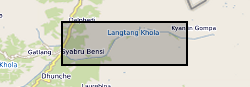
This is a polygon shapefile inventory of 183 coseismic and climate-triggered landslides in the south-western portion of Langtang Valley Nepal. All mapped landslides were those visible in the landscape during the period 2017 – 2018. Landslides were mapped using a combination of field and remote sensing methodologies (see lineage). The inventory includes the landslide locations, perimeters (Length field), areas, types, and whether a given landslide was mapped in the field or remotely. These landslides were mapped for a range of purposes, from conducting landslide susceptibility assessments, to investigating landslide processes and preconditioning.